

Washington, D. C. DCGenWeb ProjectGenealogy Research, Resources, and Records
Maps
 |
Andrew Ellicott's 1792 revision of L'Enfant's plan for Washington, D.C

|
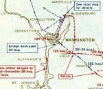 |
The Road to Washington, The War of 1812 in the Washington area |
 |
1888 Streetcar Map of DC
|
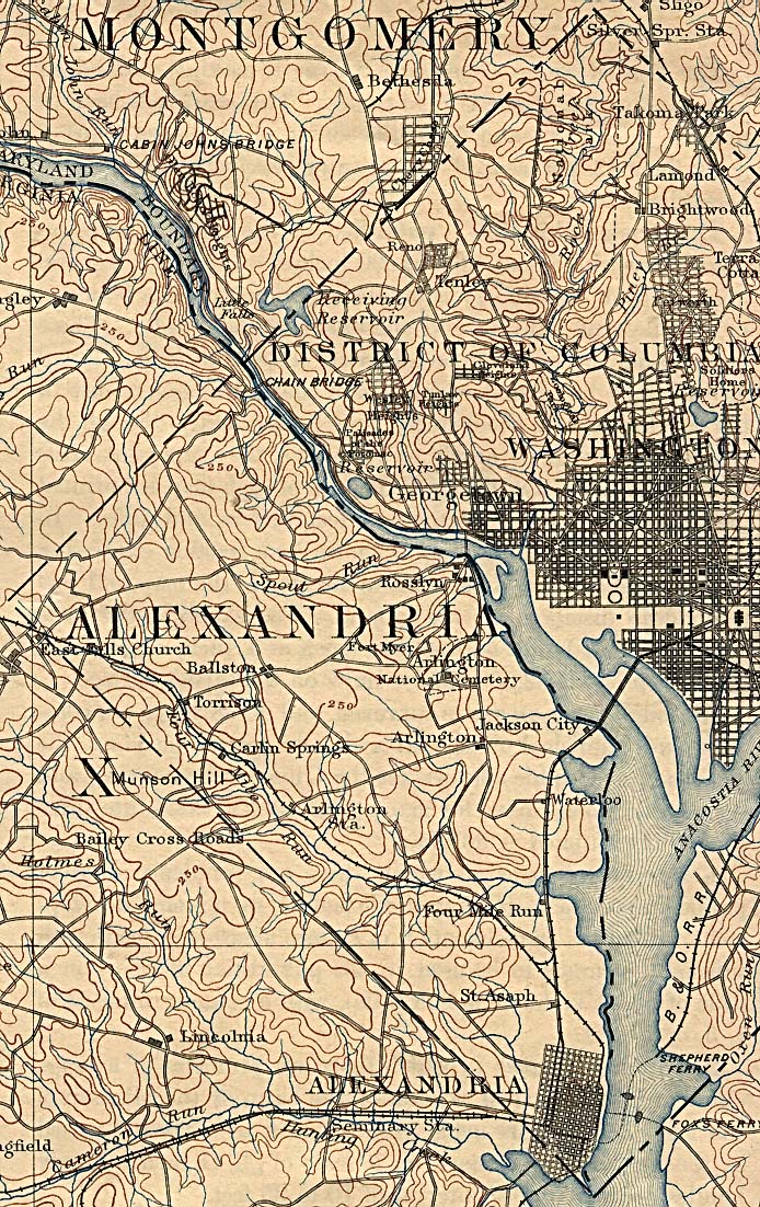 |
1894 Map of DC and Alexandria Courtesy of the University of Texas Libraries, The University of Texas at Austin. |
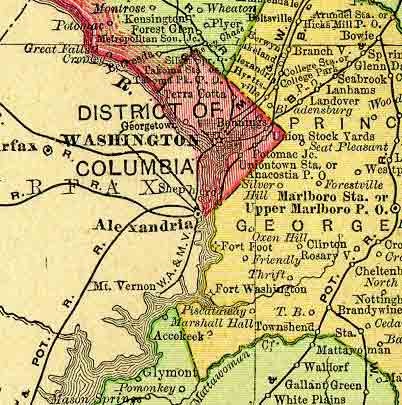 |
1895 Rand McNally Atlas Map of DCAnacostia - Population 1,027; Post Office; Railroad Station; Express OfficeBenhing's - Population 267; Post Office; Railroad Station; Express Office Benning - Post Office Brightwood - Population 153; Post Office Brookland - Population 86; Post Office Brooks - Post Office East Capitol - Post Office Garfield - Population 123; Post Office Georgetown - Population 12,578; Post Office Ivy City - Post Office Metropolitan Junction - Railroad Station; Express Office Navy Yard - Railroad Station; Potomac Junction - Railroad Station; Shepherd - Railroad Station; Express Office Silver Springs - Railroad Station; Express Office South Washington - Post Office Tacoma Park - Population 189; Post Office Takoma - Railroad Station; Tenallytown - Population 278; Post Office Terra Cotta - Population 57; Post Office; Railroad Station; Express Office Union Stock Yards - Railroad Station; Uniontown - Railroad Station; Express Office University Station - Railroad Station; WASHINGTON - Population 230,392; Post Office; Railroad Station; Express Office Winthrop Heights - Population 23; Post Office |
 |
1899 Map before Georgetown street renaming
|
 |
Animated Map of DC
|